![]() Resilient Living Shoreline
Resilient Living Shoreline
Summer 2019
Columbia
University Graduate School of Architecture, Planning and Preservation
Urban Design Studio
Location
Sunset Park, Brooklyn, NY
Neighbourhood Scale
Critics
Tricia Martin, Nans Voron; Hayley Eber, Sagi Golan, Quilian Riano, Austin Sakong, Shin-pei Tsay
Team
Niharika Shekhawat, Jaime Palacios, Minjung Lee
NYC has 21 Industrial Business Zones. 18 of these are located in waterfront sites. The Southwest Brooklyn IBZ is located in a historical marshland. About 55% of the IBZ is located under the flood zone. Global warming, increasing sea levels and extreme weather conditions threaten this manufacturing zone, as well as the prosperity of the community. The project is about providing a resiliency framework to protect the waterfront IBZ through the lens of Ecology, Community and Economy: A Resilient IBZ.

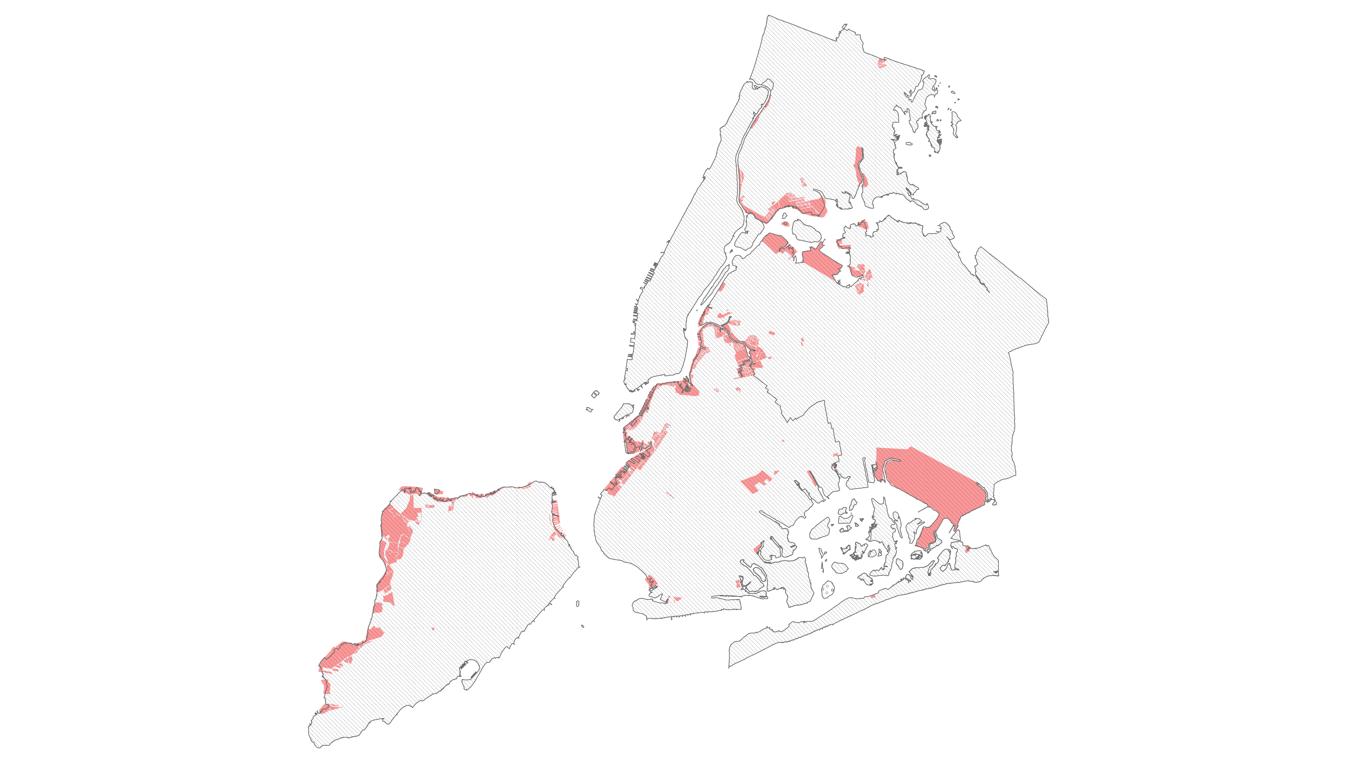

New York City is the largest regional economy of the United States. Manufacturing is a major contributor to its growth. There was an industrial decline in the mid 90’s and, in response, in 2006 New York City created Industrial Business Zones to protect manufacturing areas and continue to provide good paying jobs for the working class.

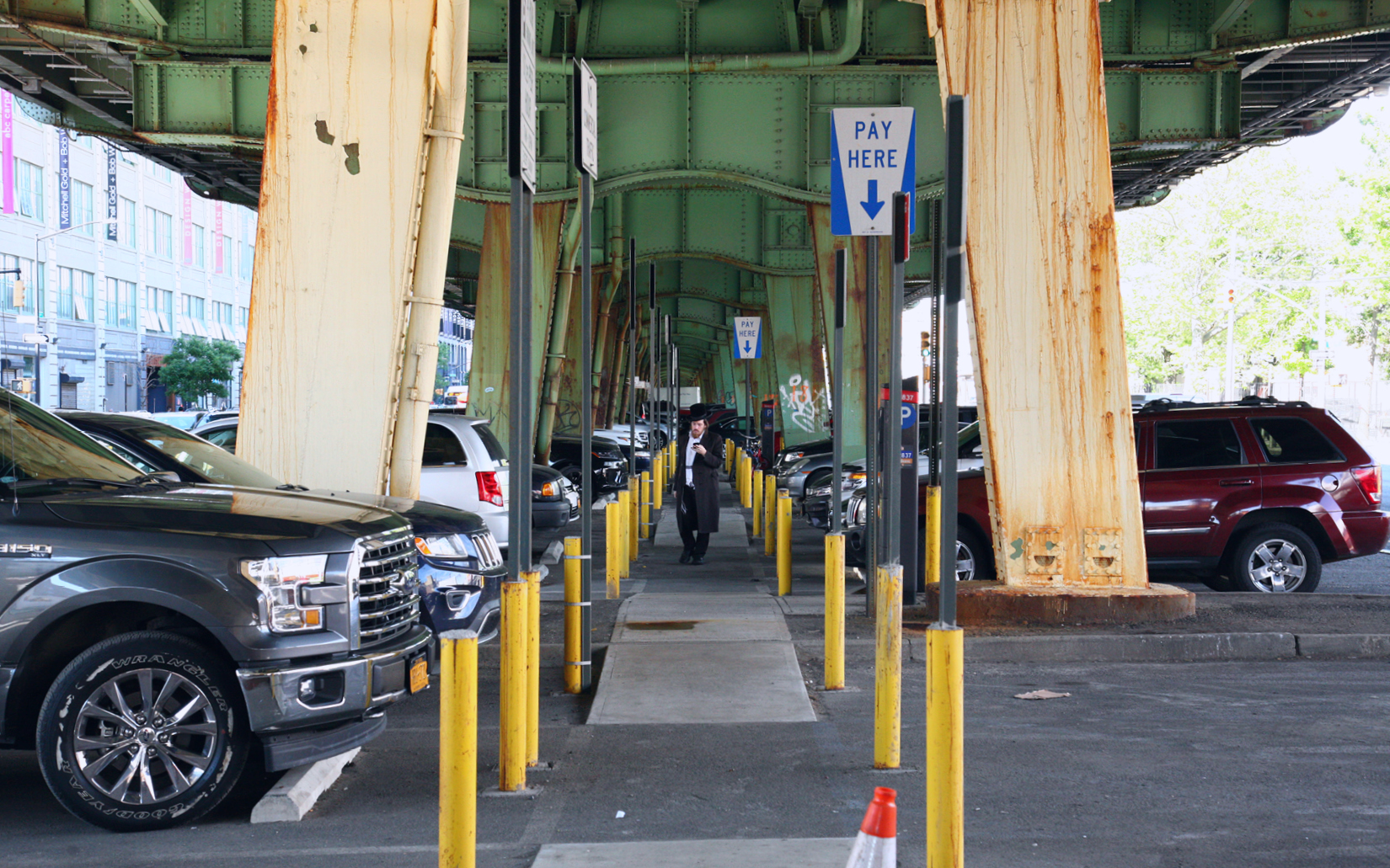
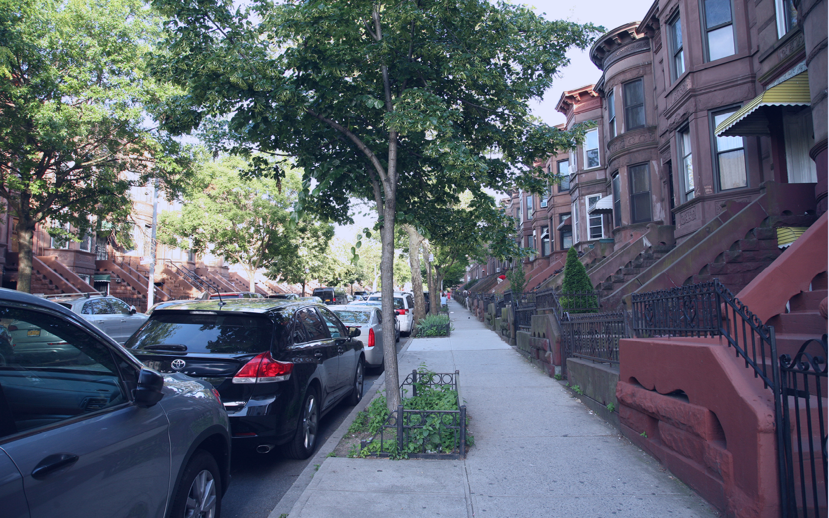
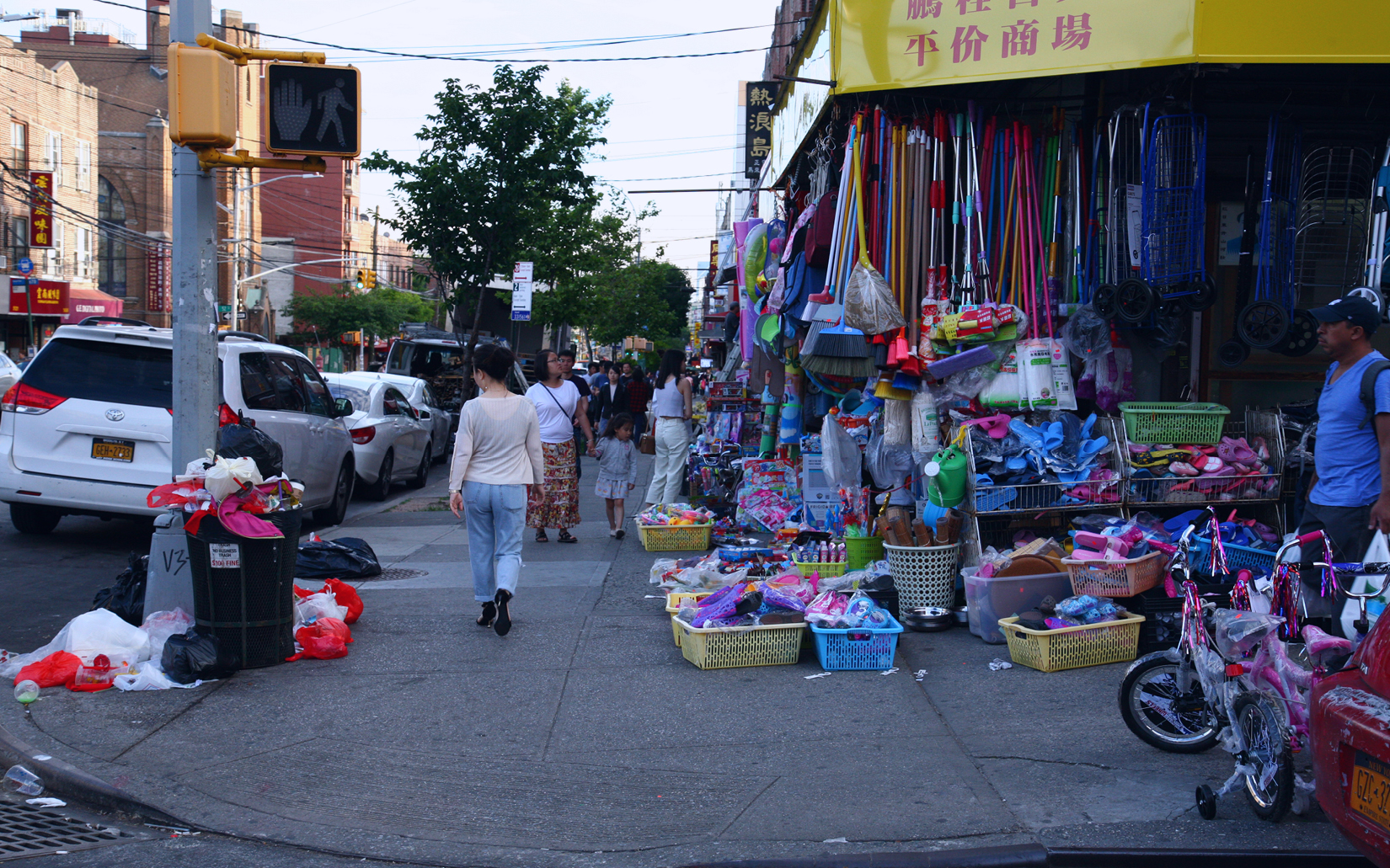
Sunset Park, a neighborhood located in the South West of Brooklyn where one third of the population lives below the New York City government poverty rate, is home to an IBZ. Although, the area is currently underutilized, it holds hopes and opportunities for the generations to come. However, the IBZ is at risk. The Southwest Brooklyn IBZ is located in a historical marshland. About 55% of the IBZ is located under the flood zone. Global warming, increasing sea levels and extreme weather conditions threaten this manufacturing zone, as well as the prosperity of the community. So, how can we make a Resilient IBZ that advocates for ecology, protects the economy, and safeguard the future of the local people? The key is on its waterfront.
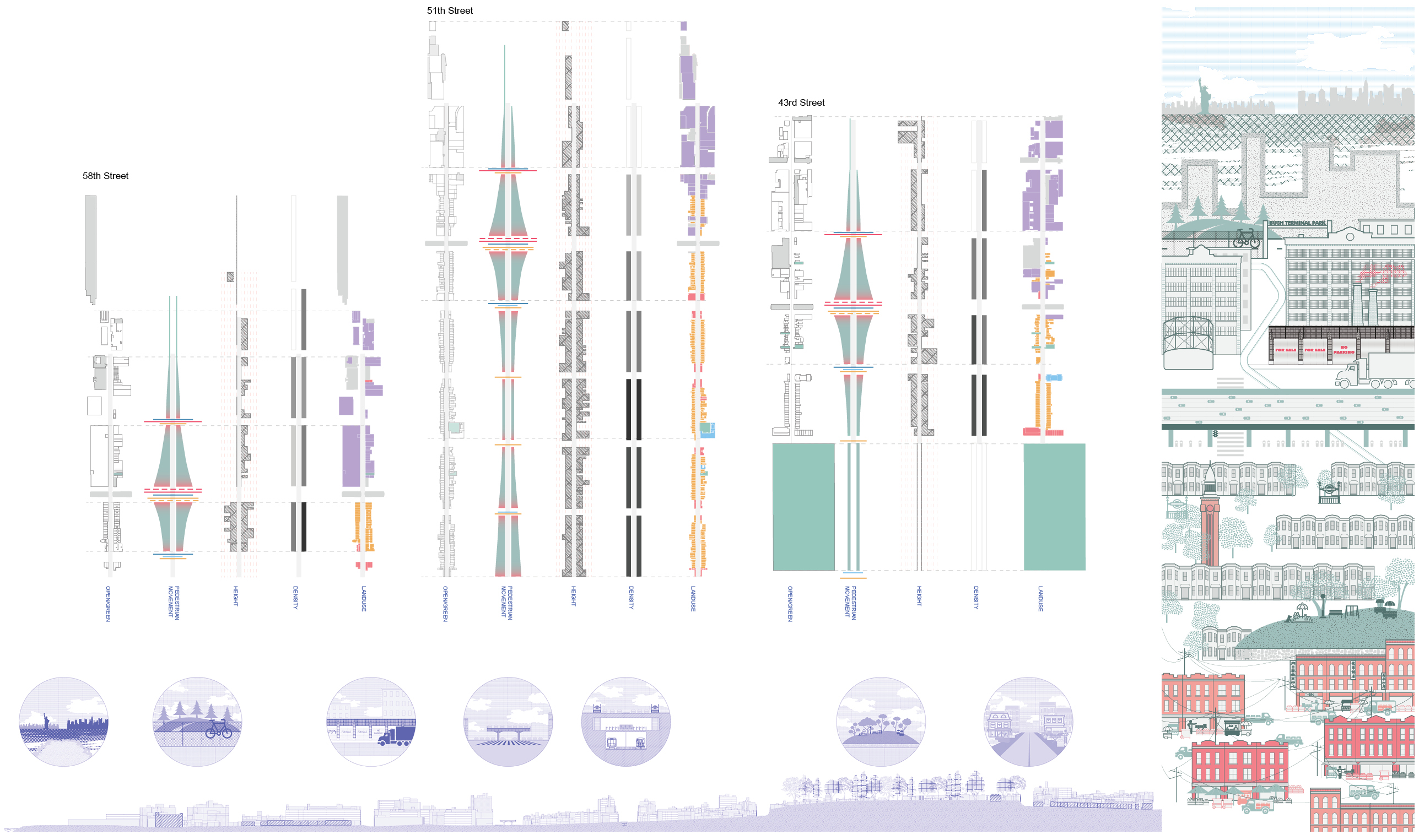 Top: Analysis of the streets of Sunset Park for potential areas of intervention. Showing Landuse, density, building height, pedestrian movement density, and location of open/green space. Bottom: Section through Sunset Park from East to West
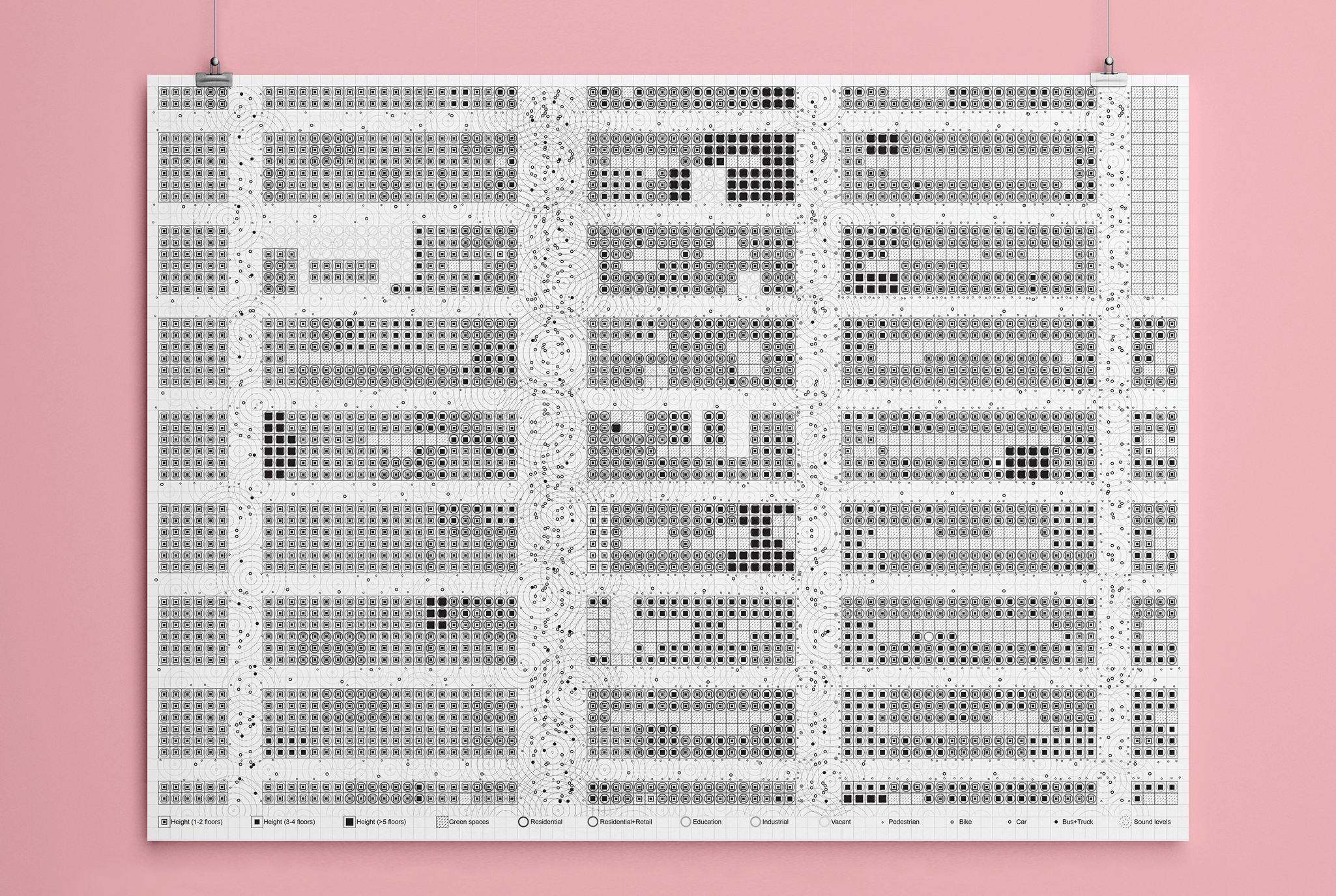 Analysis of the streets to understand current conditions
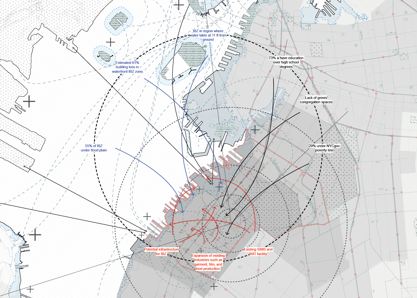 Sunset Park has 1/3 of the population lives below the NYC government poverty rate. The water table of the region does not allow for sufficient water absorption during flooding and 55% of the IBZ is under the 2020 flood plain. Most of its built infrastructure will face severe losses projecting towards the future.
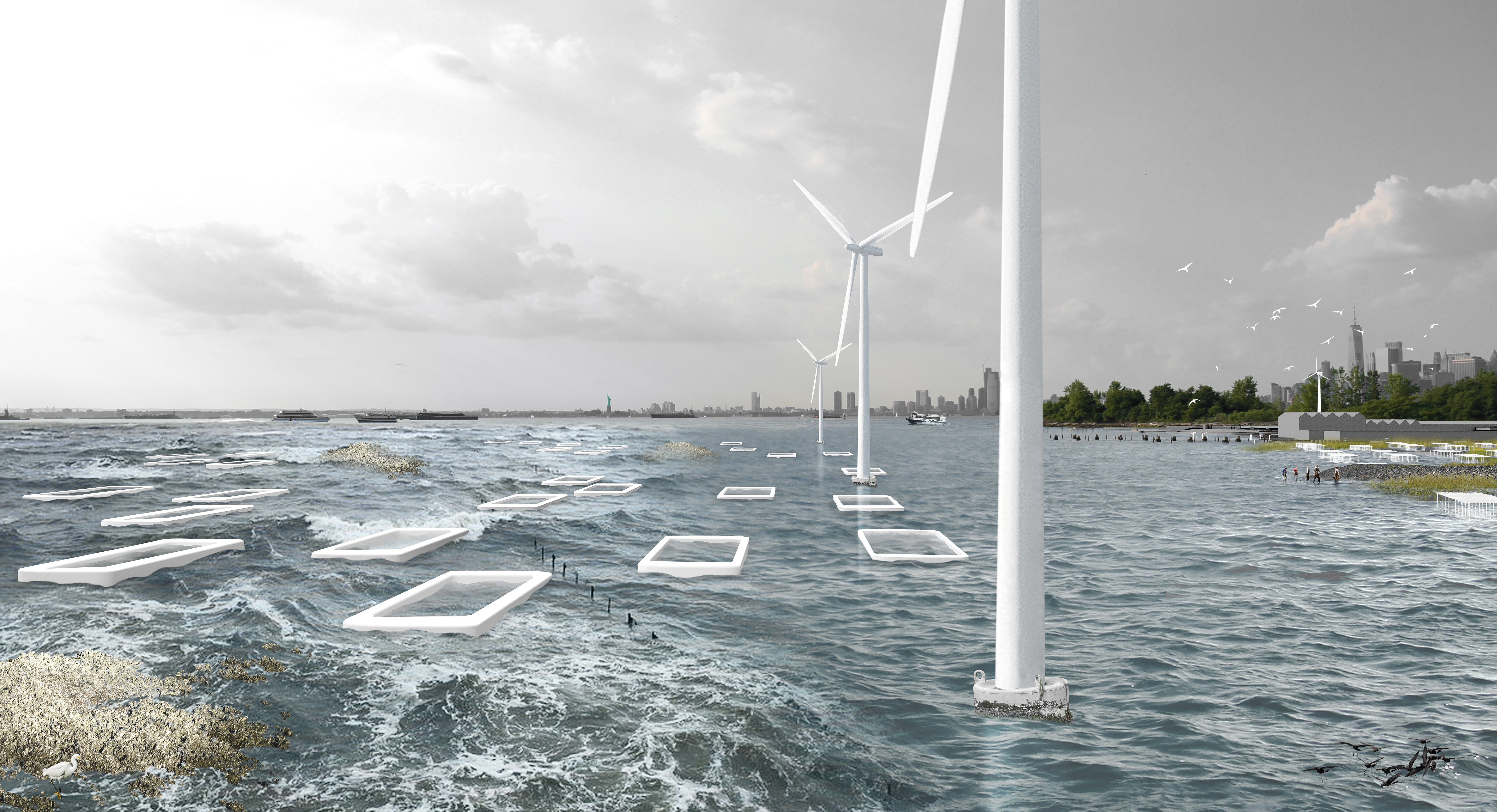
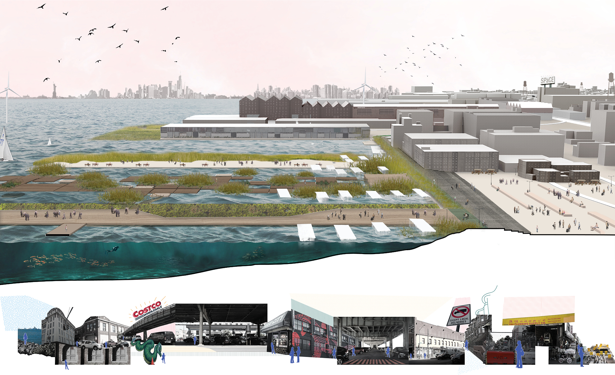 Top: Render showing how the project is about providing a resiliency framework to protect the waterfront Industrial Business Zones through the lens of Ecology, Economy and Community. Bottom: Collage section through Sunset Park.

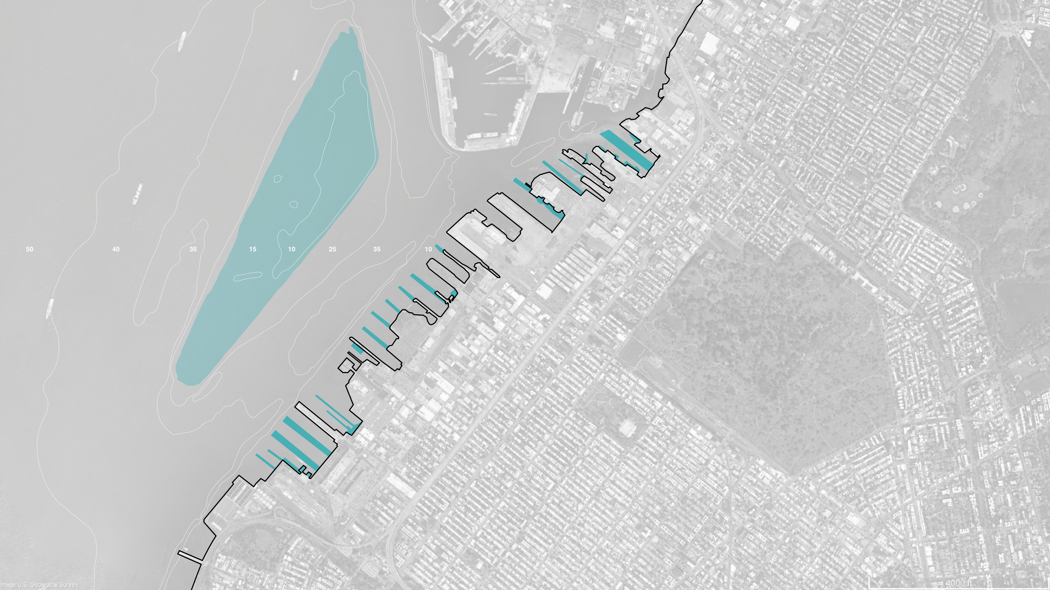
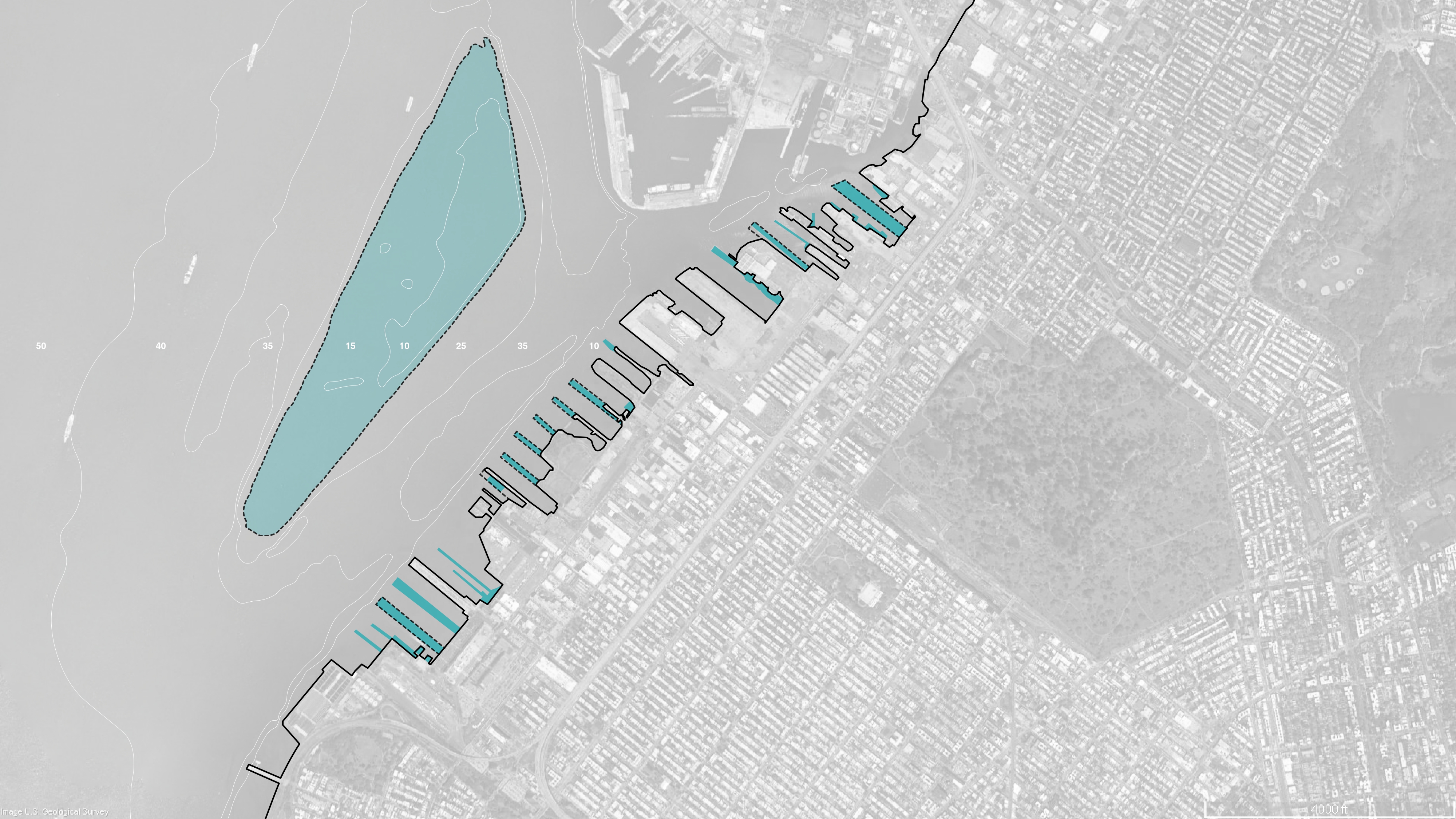
Bathymetric maps from the NOAA show that abandoned piers as well as the Bay Ridge Flat lays underwater. The industrial footprint left heavy pollutants and weakened the ecosystems. The IBZ is currently underutilized by the neighborhood. There is a plan by the Brooklyn Greenway Initiative to activate the area through a greenway that connects from Red Hook to Bay Ridge. Taking advantage of the existing bathymetry, we plan to use natural ecosystems to reduce the energy of the waves and restore the coastal environment by cleaning the water and providing habitat. Living shorelines stabilize the shore, and reduce erosion and storm damage. They increase the flood storage capacity and strengthen the ecosystems. Hard infrastructure decays, while living shorelines naturally grow stronger over time.
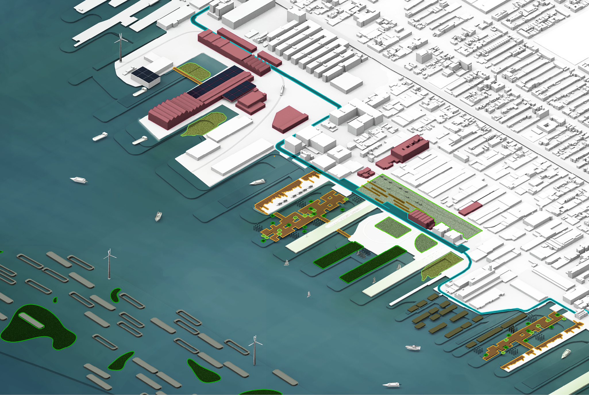 The project provides a resiliency framework to protect the waterfront Industrial Business Zones through three lenses of Ecology, Economy and Community.
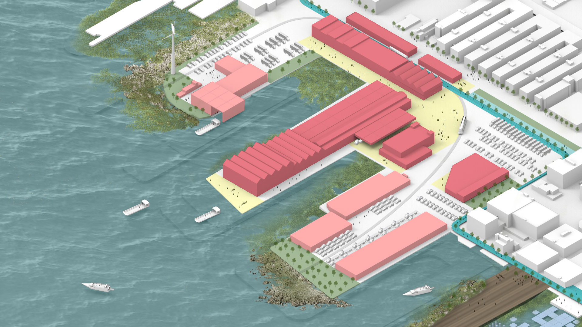
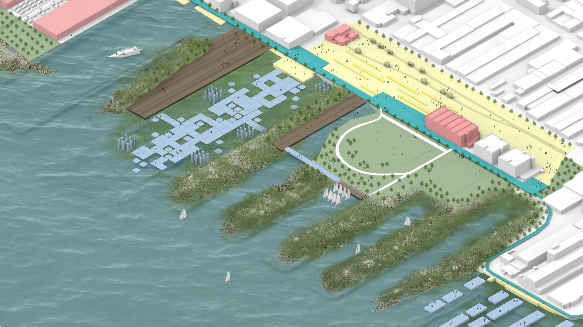
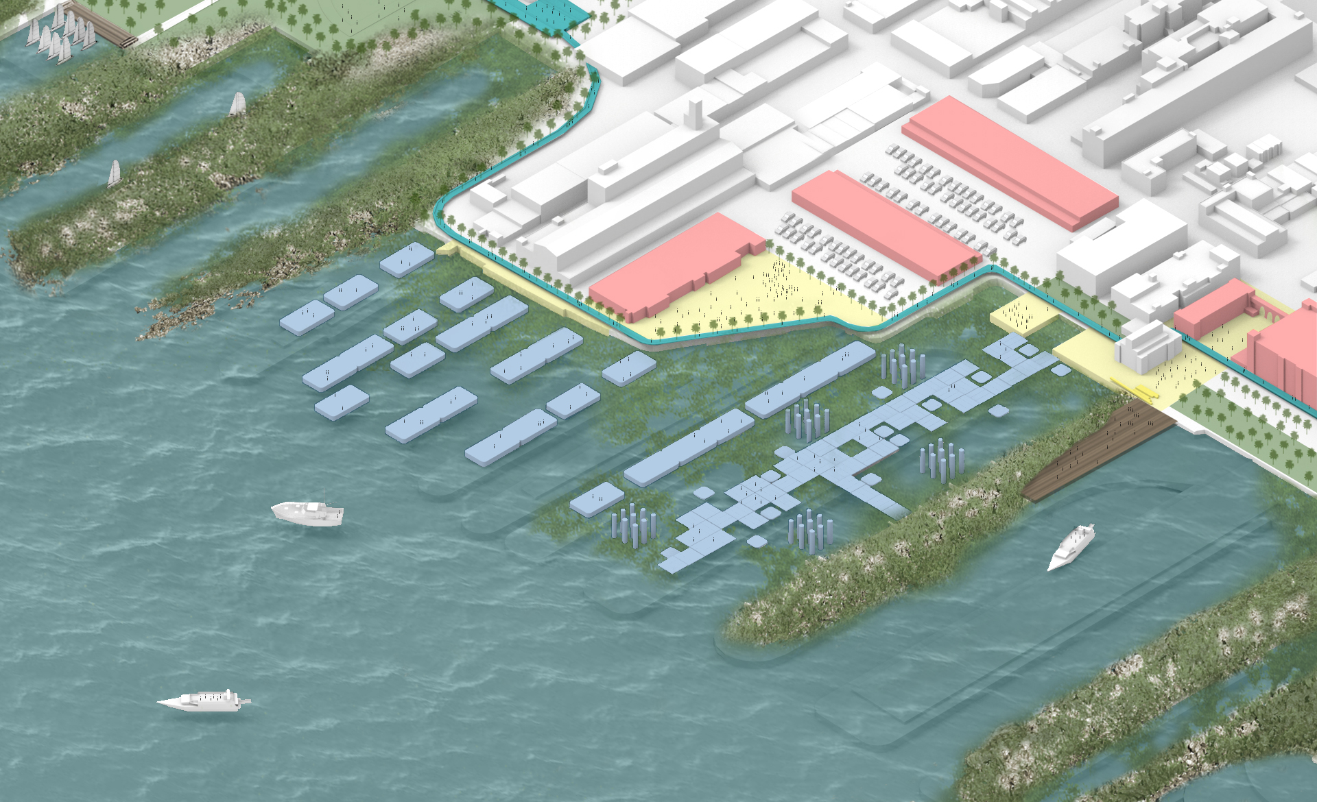

Living shorelines stabilize the shore, and reduce erosion and storm damage. They increase the flood storage capacity and strengthen the ecosystems. Hard infrastructure decays, while living shorelines naturally grow stronger over time. We are proposing to connect to the existing greenway, and use this connection as a barrier for sea level rise and inland water overflow.
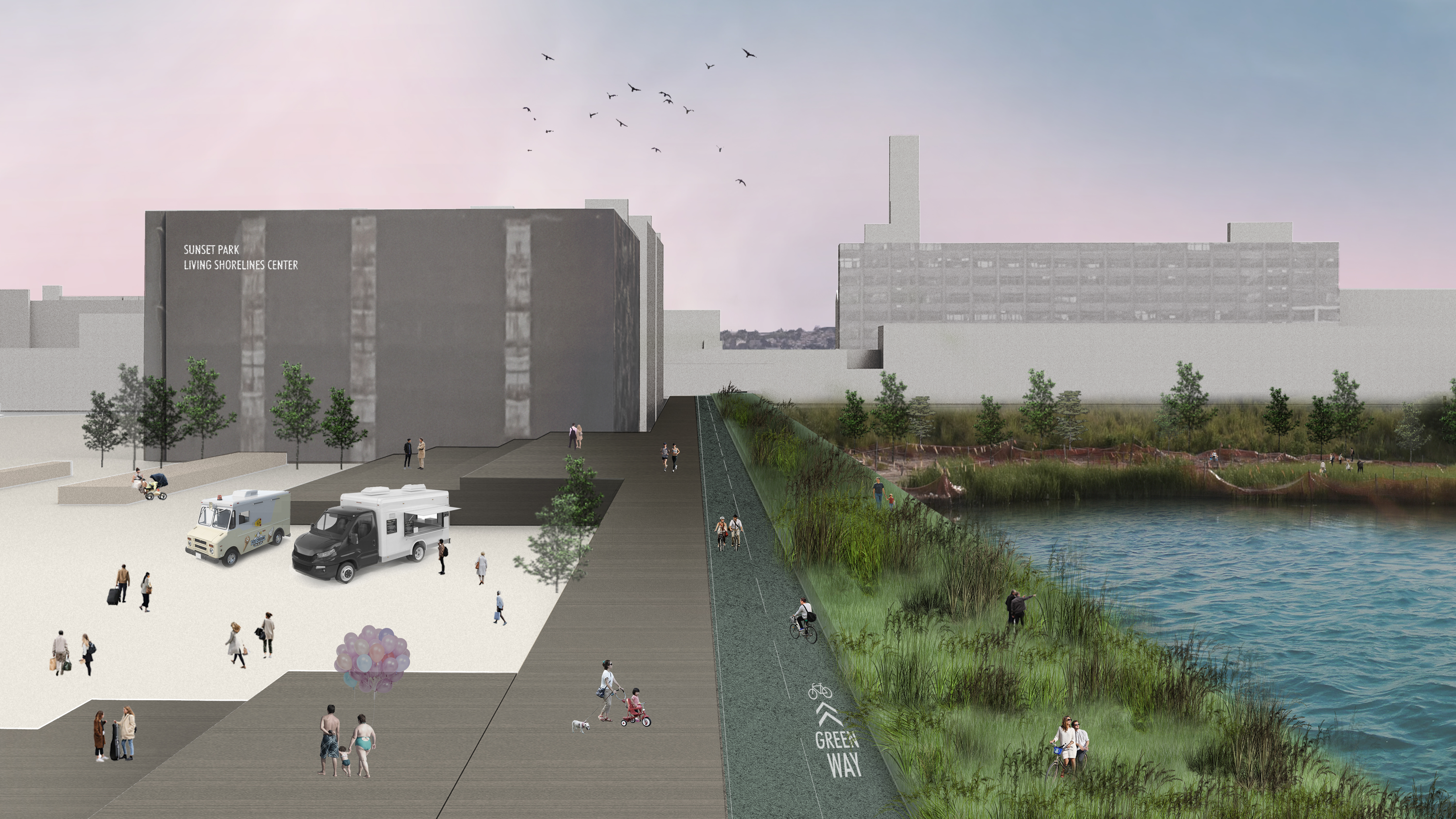
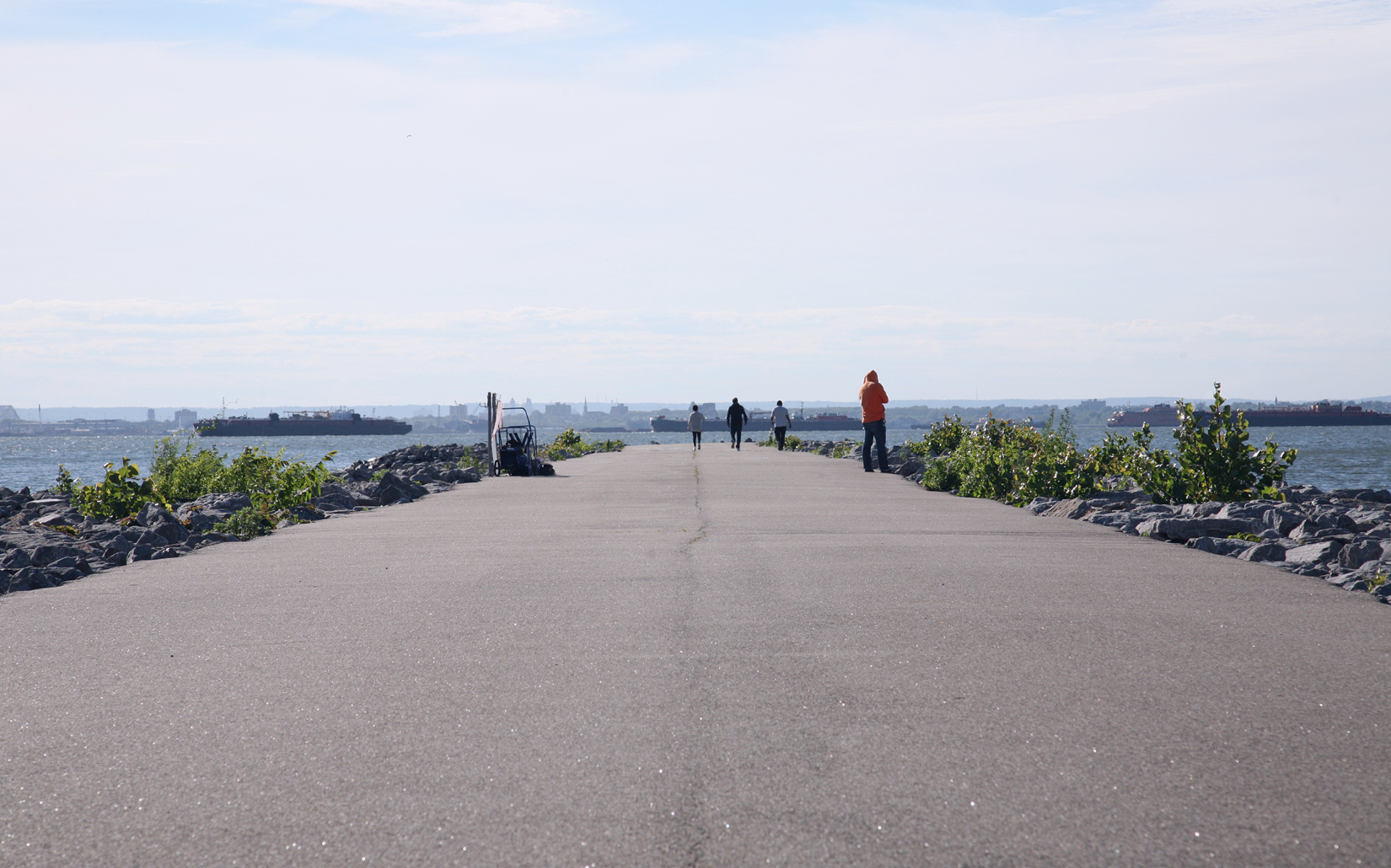
 The Greenway will provide connectivity to Red Hook and Bay Ridge by activating the area. It runs along the waterfront making it climate resilient. Its morphology adapts to its context, responding to the built environment and the topography of the site.
The first step is to raise awareness by taking advantage of the local resources and using the current infrastructure assets. Educational facilities and training centers will inform the local community about the program and provide a series of green job opportunities. To restore the bio-network, we need to nurse oysters, seagrass, and salt marsh. The nursery itself will start working as a natural purifying system. To manufacture the needed resources, recycled materials from the Sims Recycling Facilitywill be processed and developed on site, powered by our wind farms.
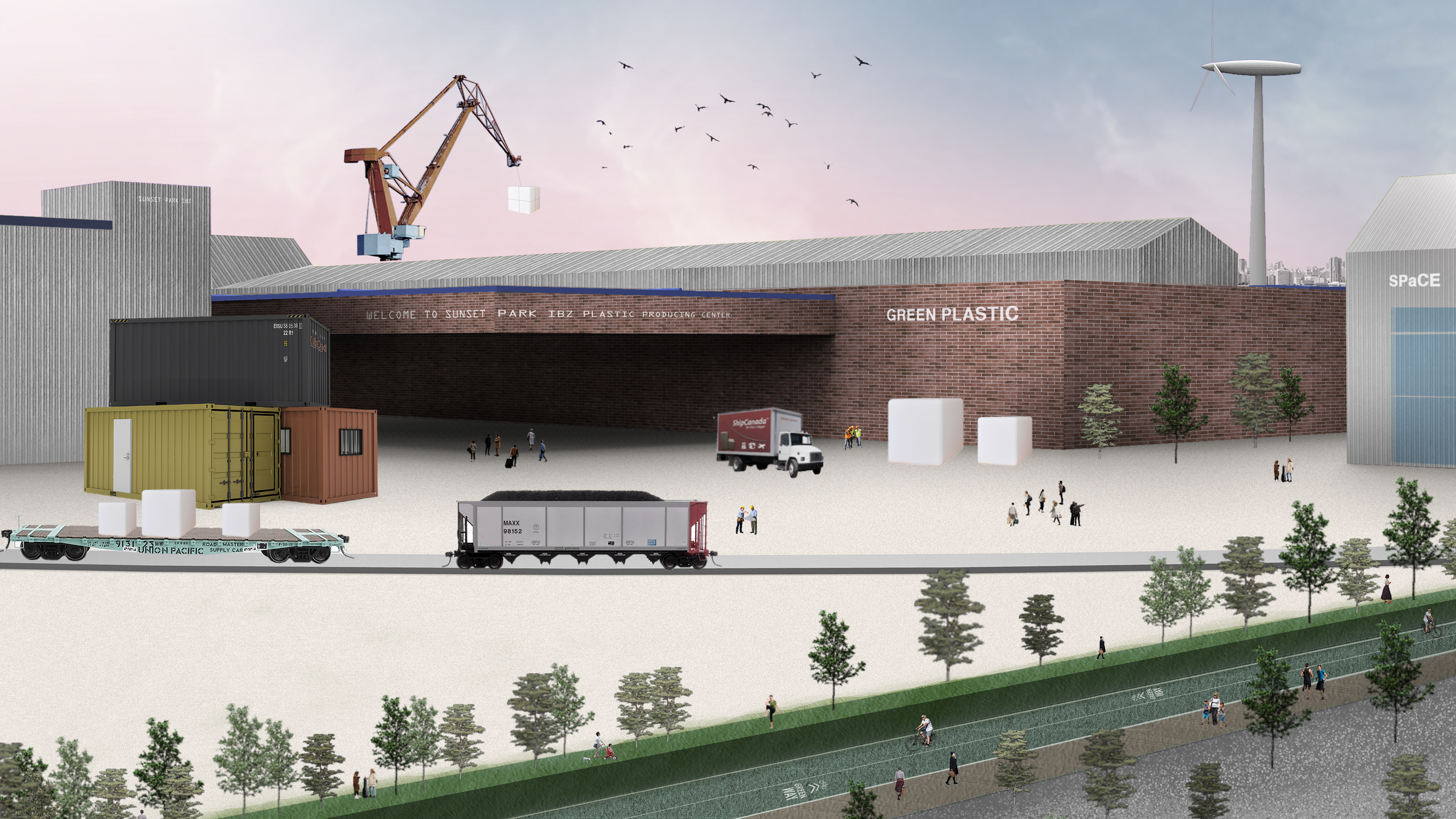 To restore the environment, locally manufactured materials made in facilities powered by wind energy. The Resource & Training Center will design and develop ways to improve processes by testing the products in the Testing Facility.
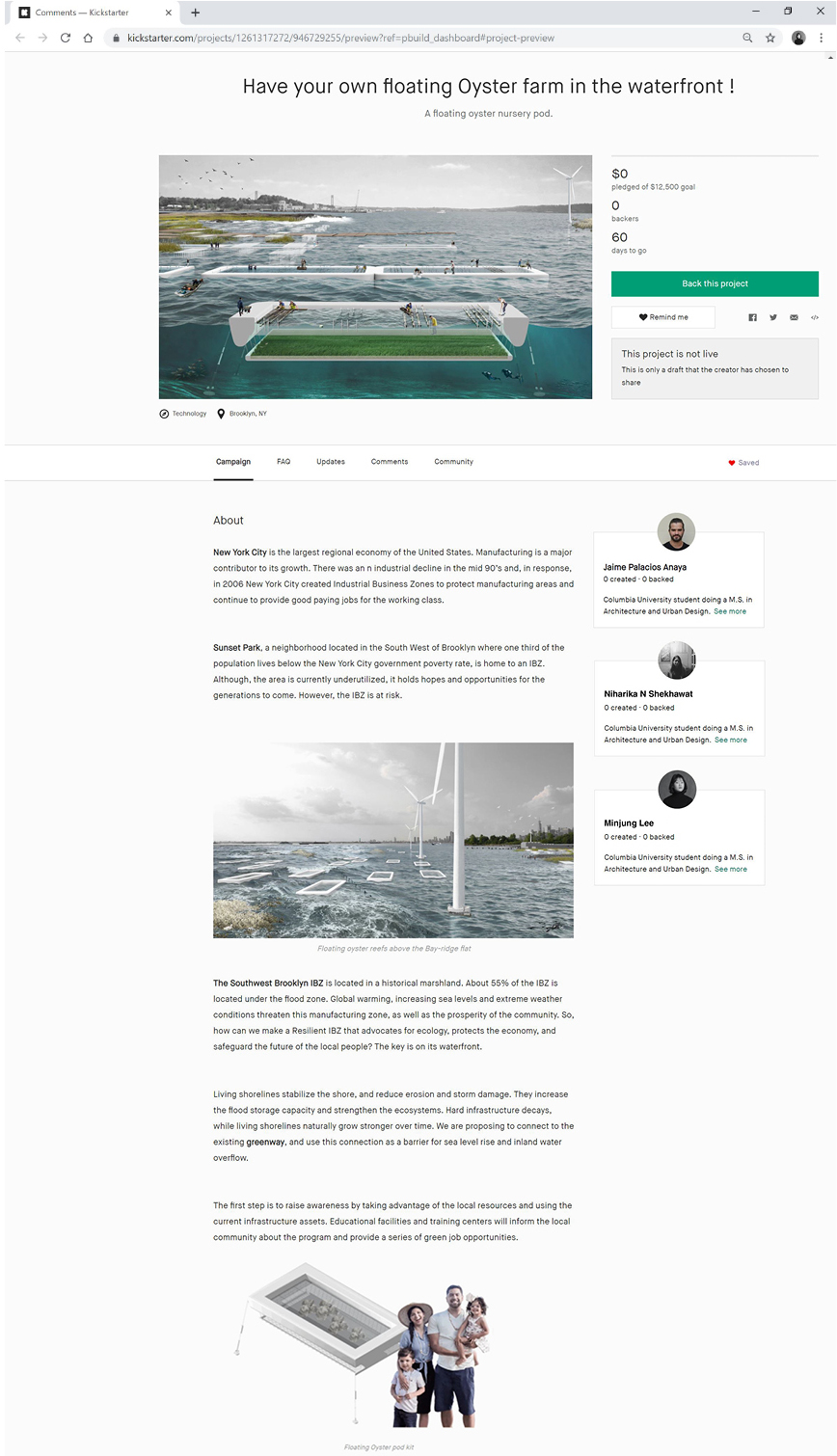
Kickstarter campaign for make-your-own Oyster pod
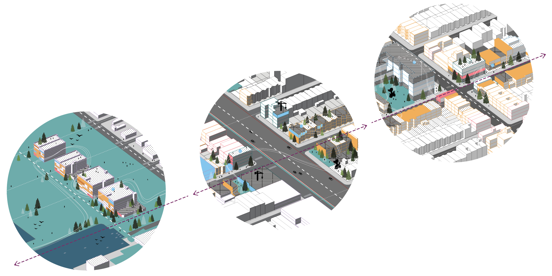 Integration of the different parts of Sunset Park such as the waterfront, the transportation and the community.
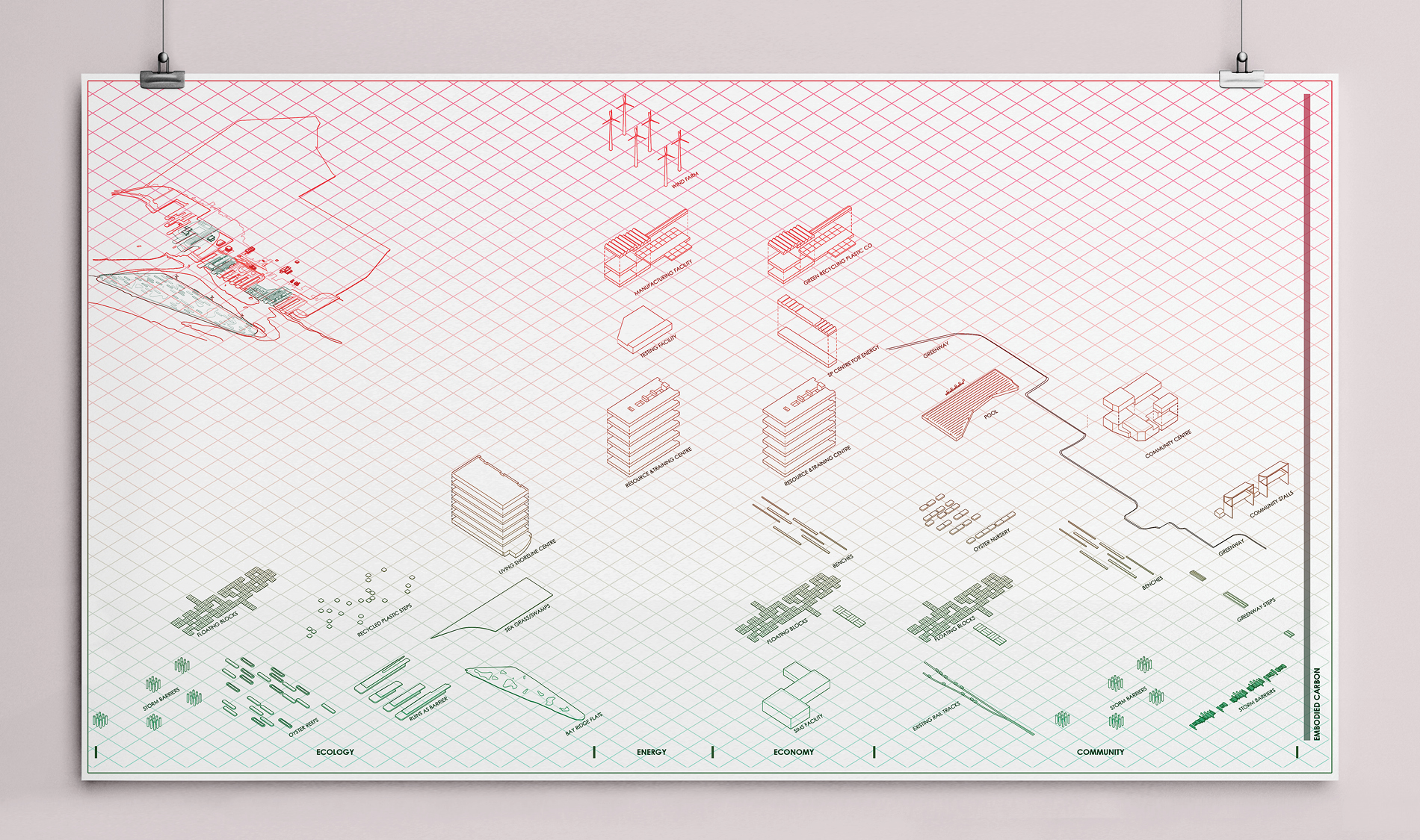 A graph showing the most to least Embodied Energy of parts of the project, sorted by Economy, Ecology, Economy and Community category.
Manufacturing will help the community thrive by providing better jobs, giving access to local products, and reducing their energy expenses. The work of the community will safeguard the industrial business zone, and it will attract new industries that add value to the community: an economy of sharing. We envision a protected IBZ that becomes stronger over time. A place that supports the community by securing its economy. An IBZ that advocates for environmental and social justice. A Resilient IBZ.
 Resilient Living Shoreline